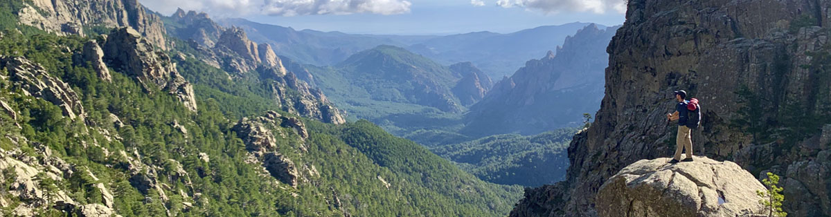
The GR20 is a long hike that crosses the Mediterranean island of Corsica from the north to the south. It is considered as one of the most difficult GR (“Grande Randonnée”) footpath because of its steep and rocky paths. There are some sections with chains, rock climbing and footbridges.
The whole trail is about 180 km long with about 12,000m of elevation gain and can be extended with some variant routes and beautiful summits.
Highlights
There are a few highlights that make this trek so special:
- It is one of the hardest GR, and you will feel very proud each day after conquering its different stages
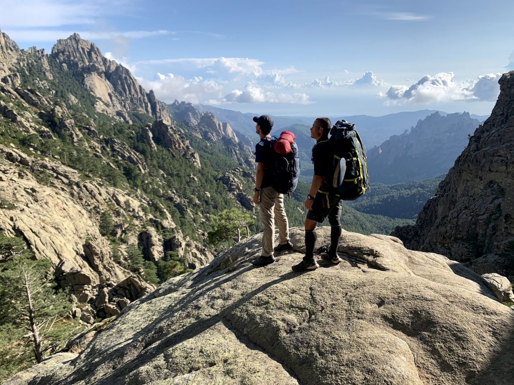
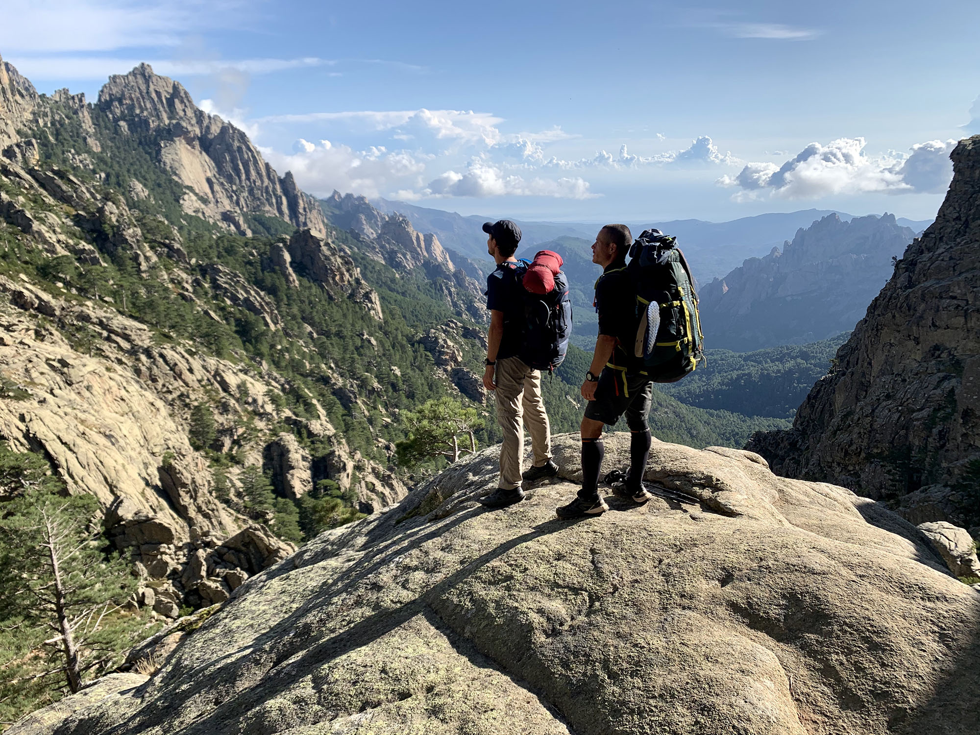
- Expect to meet incredible people on the way from all Europe, plenty of solo-hikers ready to team up
- All refuges have a special atmosphere: local food, Corsican songs
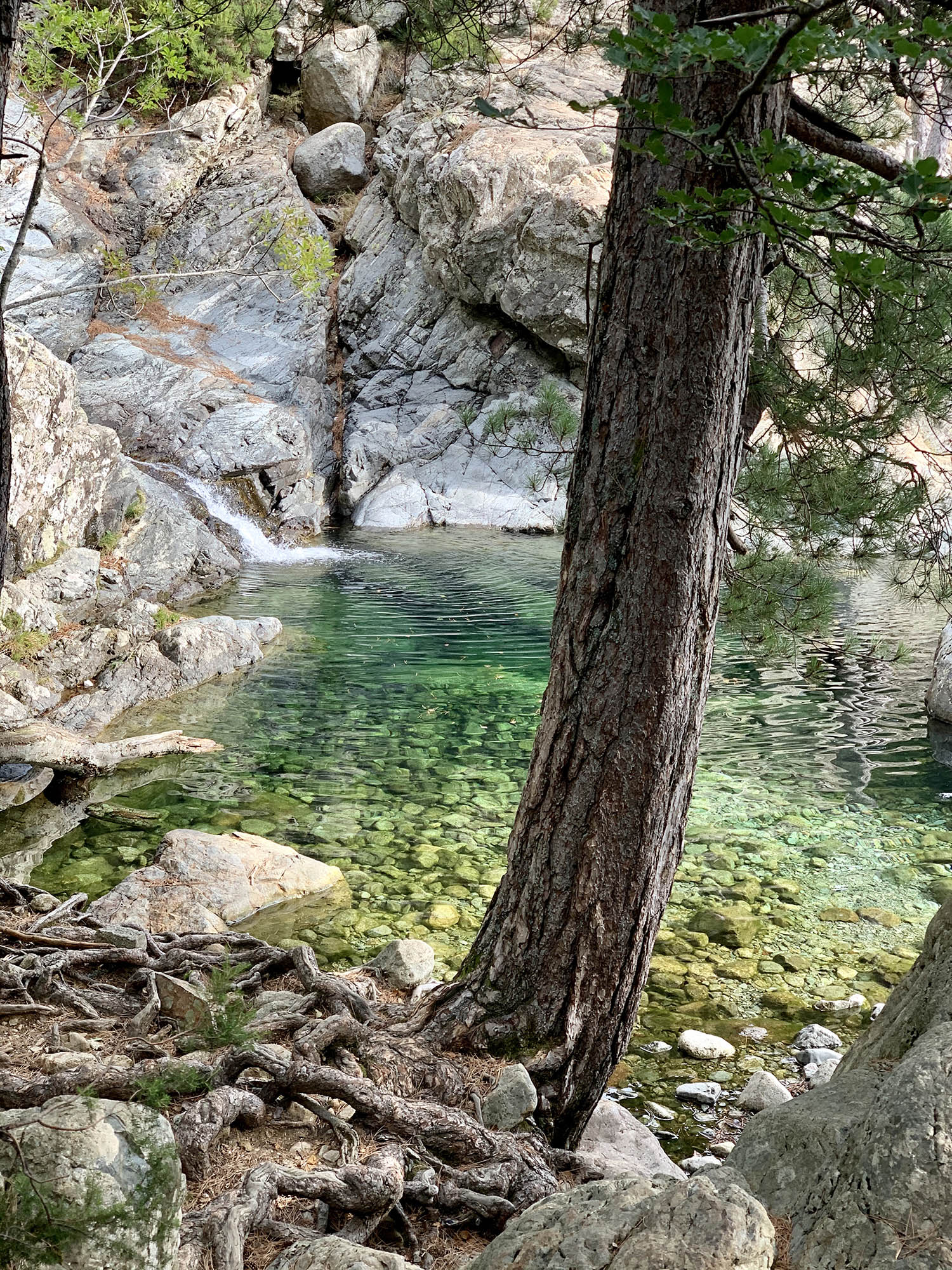
- You will be able to swim and dive in all beautiful natural pools and rivers
- Very different landscapes between north and south sections
- Monte Cinto, highest Summit of Corsica, 2706m
- Aiguilles de Bavella (Bavella Needles), majestic rocky spikes of red granite
- Cascade des Anglais (English Waterfalls), lovely waterfall
Aiguilles de Bavella 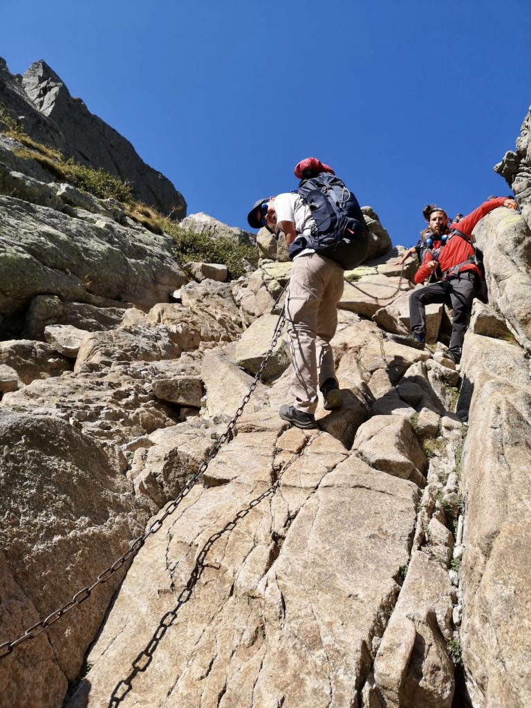
Using the chains 
Hidden pool

Duration
It takes about 16 days to complete the entire trek. It is also possible to do only half because there is a railway station conveniently located in the middle of the island (Vizzavona) with lines going to the main cities of Corsica. Based on your hiking level you can double and even triple the stages and shorten your stay in the mountains if you wish to do so:
- 3 to 7 days: Expert level, expect 10-20 hours of hiking per day. At this speed you come for the physical challenge and might run when possible.
- 8 to 12 days: Great level, 8-12 hours of hiking per day. If you hike all year, you might be tempted to double all stages. I would recommend to double only the ones in the south.
- 13 to 16: Good hiking level, 4-9 hours of hiking per day. Perfect to really enjoy the trek and to have enough time to rest at the refuges.
The northern part is considered as the most difficult, between Calenzana and Vizzavona. However the southern part, between Vizzavona and Conca is not as easy as it may sound as the stages are a bit less technical but far more longer.
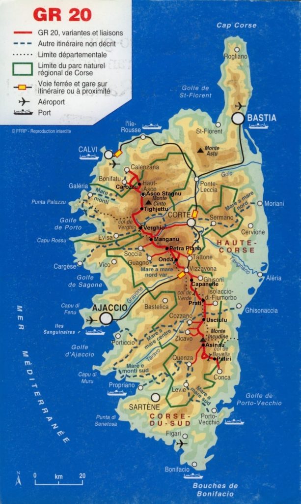
GR20 Map 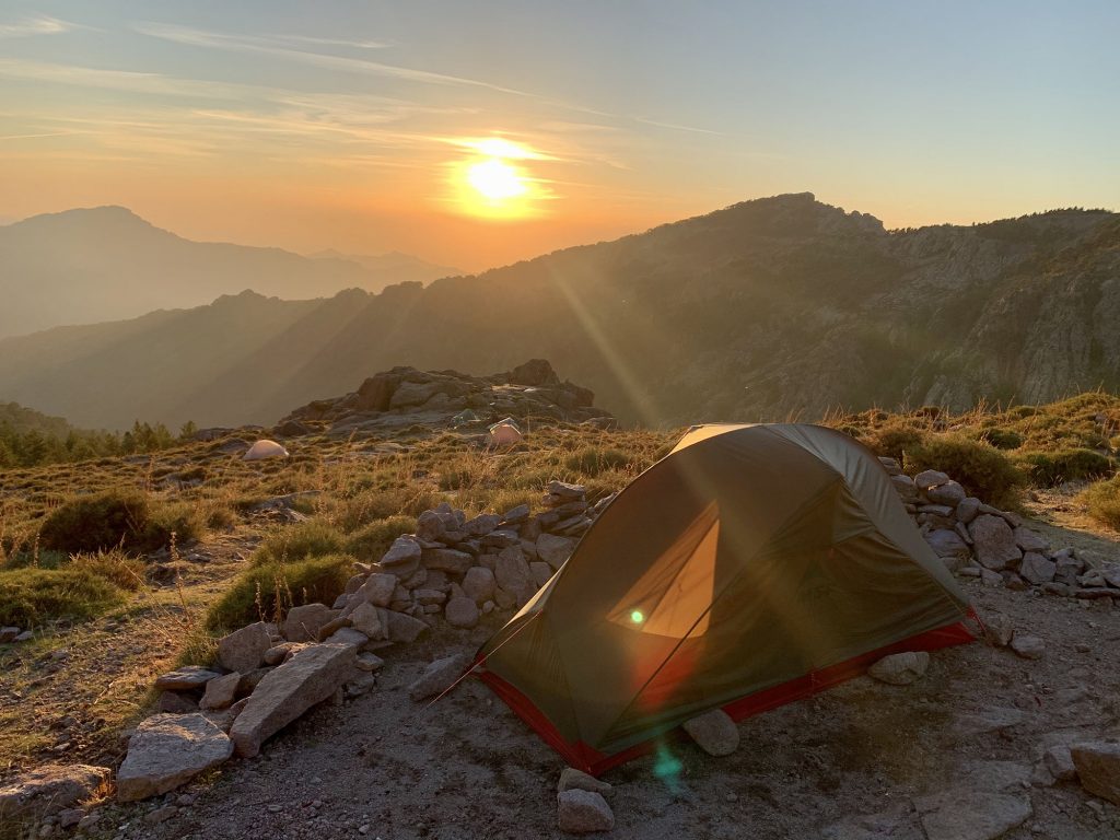
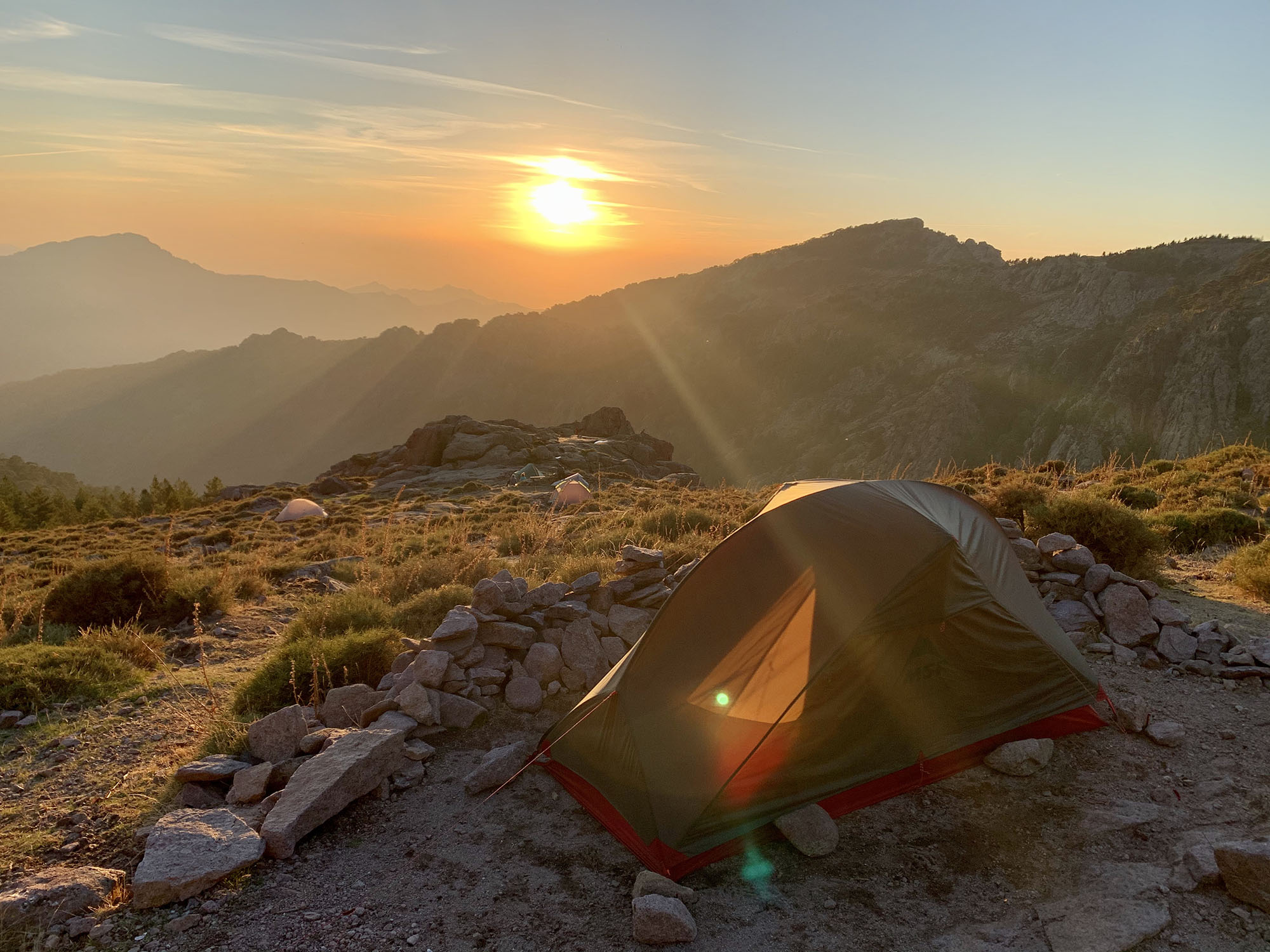
Sunset 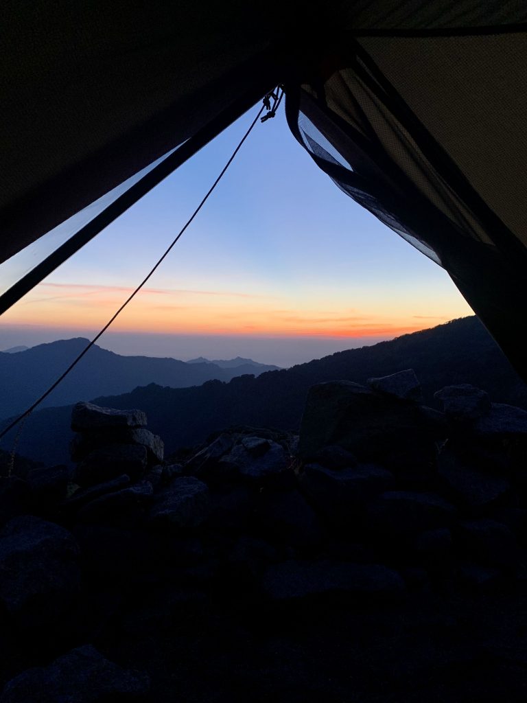
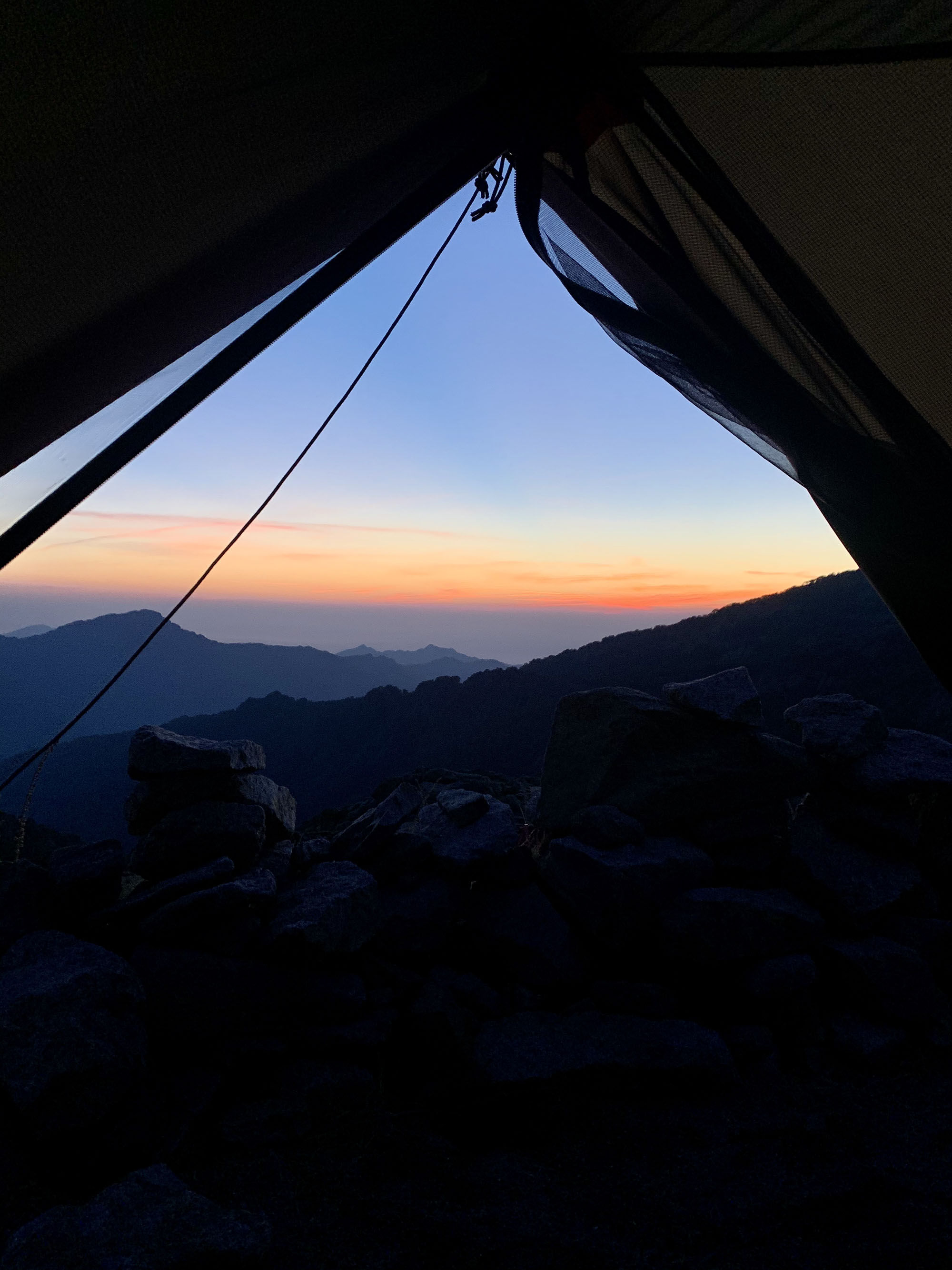
View from the tent

Difficulty and gear
Your choice in term of gear will greatly change the difficulty. It almost sounds like picking the difficulty at the beginning of a new game.
| Difficulty | Pros | Cons |
| Lightweight/confort: you leave without tent and without food. | You can go faster than most people and will be able to climb more easily. Tents rented at the refuges are usually pretty good and comfy. | You must have reservations for all refuges and won’t be able to make plan changes which is risky in the mountains with the weather. You pay much more for the tents provided by the refuges |
| Medium: you carry your tent but you will eat in the refuges. | With your tent, no need for reservations usually. You might be able to camp outside of the refuges in incredible spots if you are smart about it and look up in advance. You pay much less to pitch just a tent. | If you have your tent, you also need a sleeping pad and pillow. Adding about 2-3kg to your backpack in total. Better when shared among two people. Extra energy and time to pitch/take down your tent everyday. |
| Survivor: you carry your tent and all your food. | You are totally free from the refuges. You will pay less things on the way. It is possible to get food supplies in some refuges as well as in Vizzavona. | Massive weight for everyday food and tent. Extra energy and time to pitch/take down your tent everyday. |
If you are looking for a physical challenge, this trek won’t disappoint. Because there is a lot of rock climbing, don’t forget to optimise the weight of your backpack seriously.

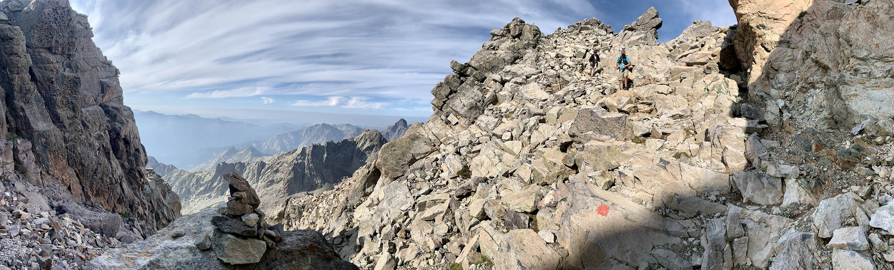
Rocks everywhere
Itinerary
| Day | Stage | Distance | Elevation gain | Elevation loss | Notes |
| 1 | Calenzana to Ortu di u Piobbu | 10.5 km | 1360 | 60 | Long way up, start early in the morning to avoid the heat (low altitude for this stage) |
| 2 | Ortu di u Piobbu to Carrozzu | 6.5 km | 780 | 910 | |
| 3 | Carozzu to Ascu Stagnu | 5.5 km | 800 | 640 | Asco has restaurants to enjoy a good meal (ski resort). Has electricity. |
| 4 | Ascu to Tighjettu | 8 km | 1200 | 1050 | Monte Cinto Summit +1h30. Sleep at “Bergerie de Ballone”, much better than Tighjettu. |
| 5 | Tighjettu to Ciottulu di i Mori | 6.5 km | 620 | 80 | Castel de Vergio is a great option to sleep between the stages. Electricity at Castel. |
| 6 | Ciottulu di i Mori to Manganu | 23 km | 650 | 1050 | |
| 7 | Manganu to Petra Piana | 8 km | 850 | 600 | |
| 8 | Petra Piana to Onda | 10 km | 850 | 600 | Spend an extra day to hike Monte Rotondo from Petra Piana +5h. One of the best view from all the summits |
| 9 | Onda to Vizzavona | 10 km | 850 | 600 | English Waterfall, more scenic than the variant. take the variant to not go through Vizzavona if you double the stages 9 and 10. |
| 10 | Vizzavone to Capannelle | 14 km | 900 | 220 | Vizzavona is great to get food/snacks/gear. Has electricity. |
| 11 | Capannelle to Prati | 17 km | 890 | 600 | |
| 12 | Prati to Usciolu | 10.5 km | 700 | 750 | Prati doesn’t have much food/options |
| 13 | Usciolu to A Matalza | 10.5 km | 400 | 650 | Usciolu, great refuge to fill up and get food/snacks |
| 14 | Matalza to Asinau | 10 km | 650 | 550 | Can charge your battery in Asinau for a fee. |
| 15 | Asinau to Paliri | 15 km | 440 | 900 | Aiguilles de Bavella, must-do if the weather is with you. Restaurants and electricity near Col de Bavella. |
| 16 | Paliri to Conca | 12 km | 160 | 970 | The refuge in Conca is pretty good to pitch your tent one last time |
Download the GPX files over here: https://www.visugpx.com/okB1eM4fzj
Half of the pleasure was the hike, the other half was to meet great people on the way. We are already talking about doing treks and hikes very soon all together! If you have a few more days after the GR, take some time to visit Porto Vecchio, Bonifacio and the Archipelago of the Lavezzi islands.